
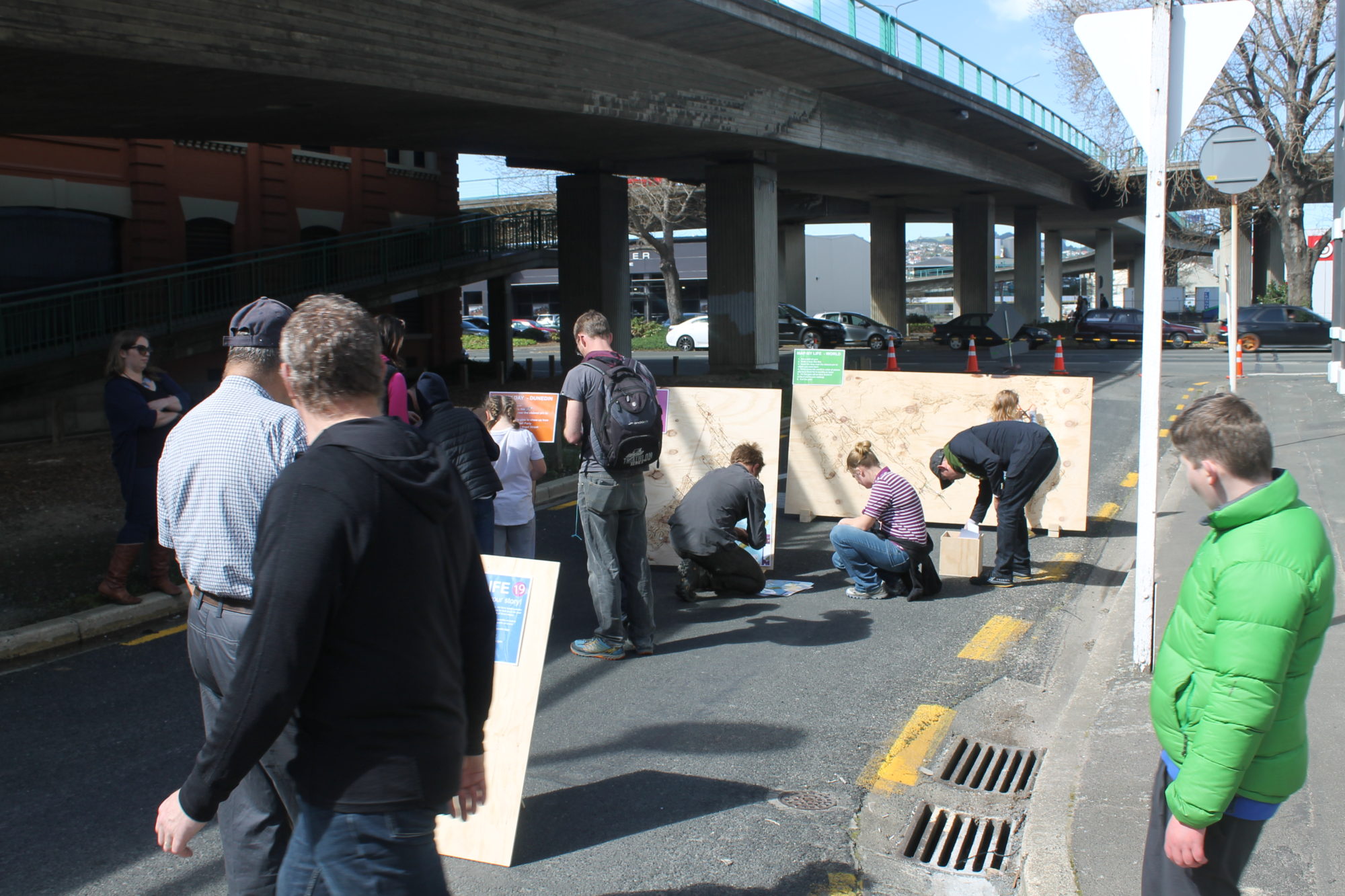
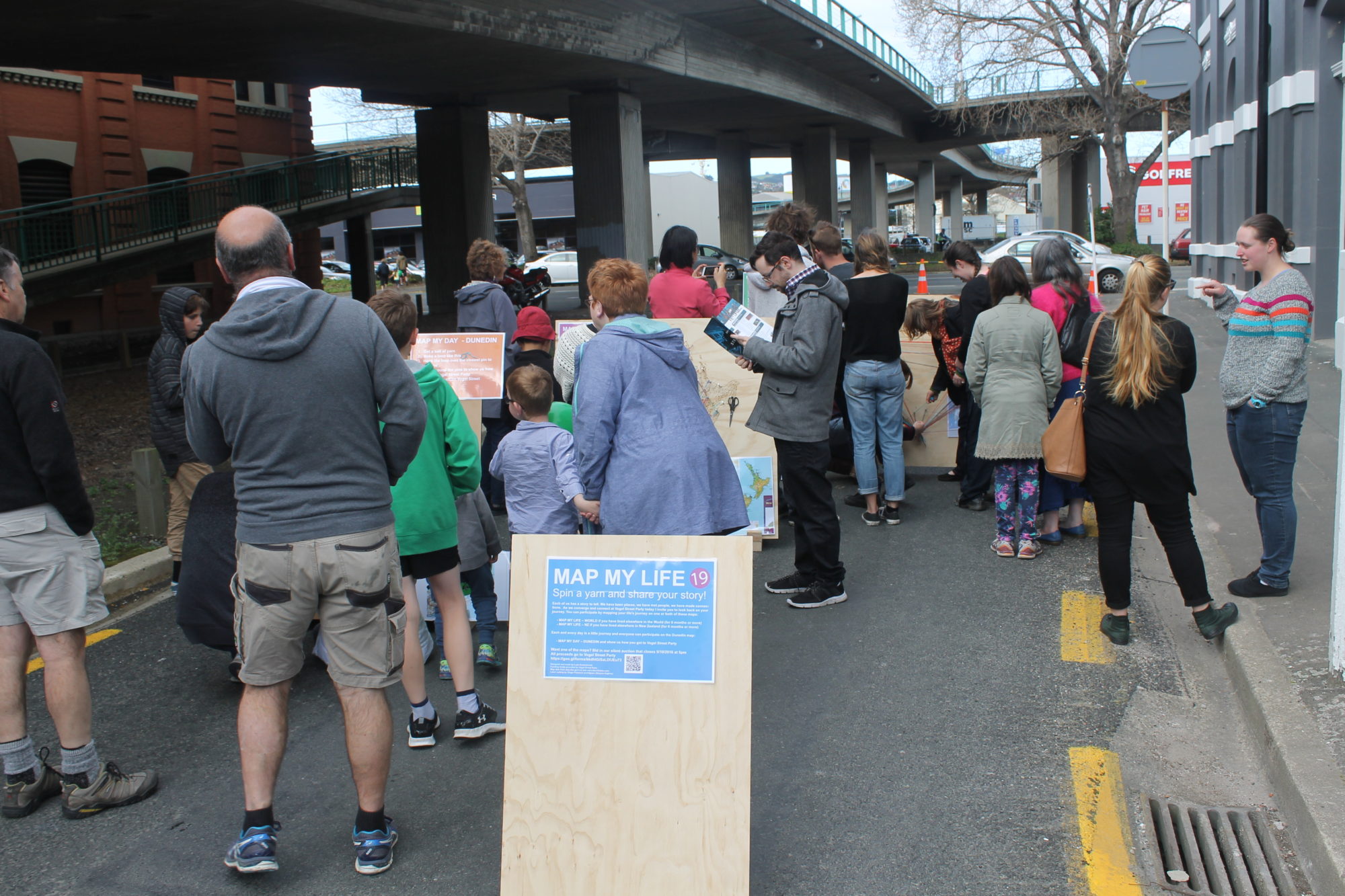
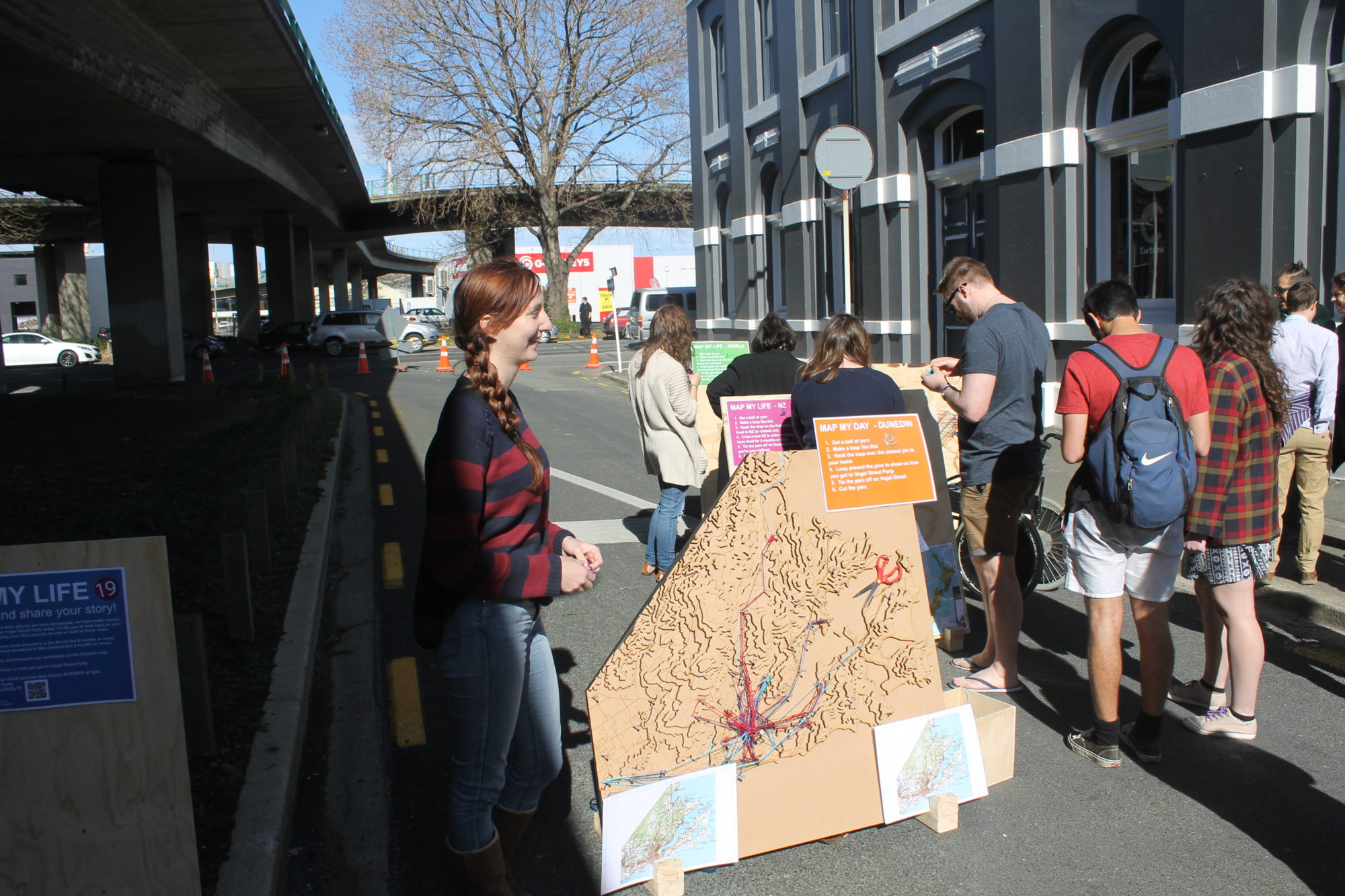
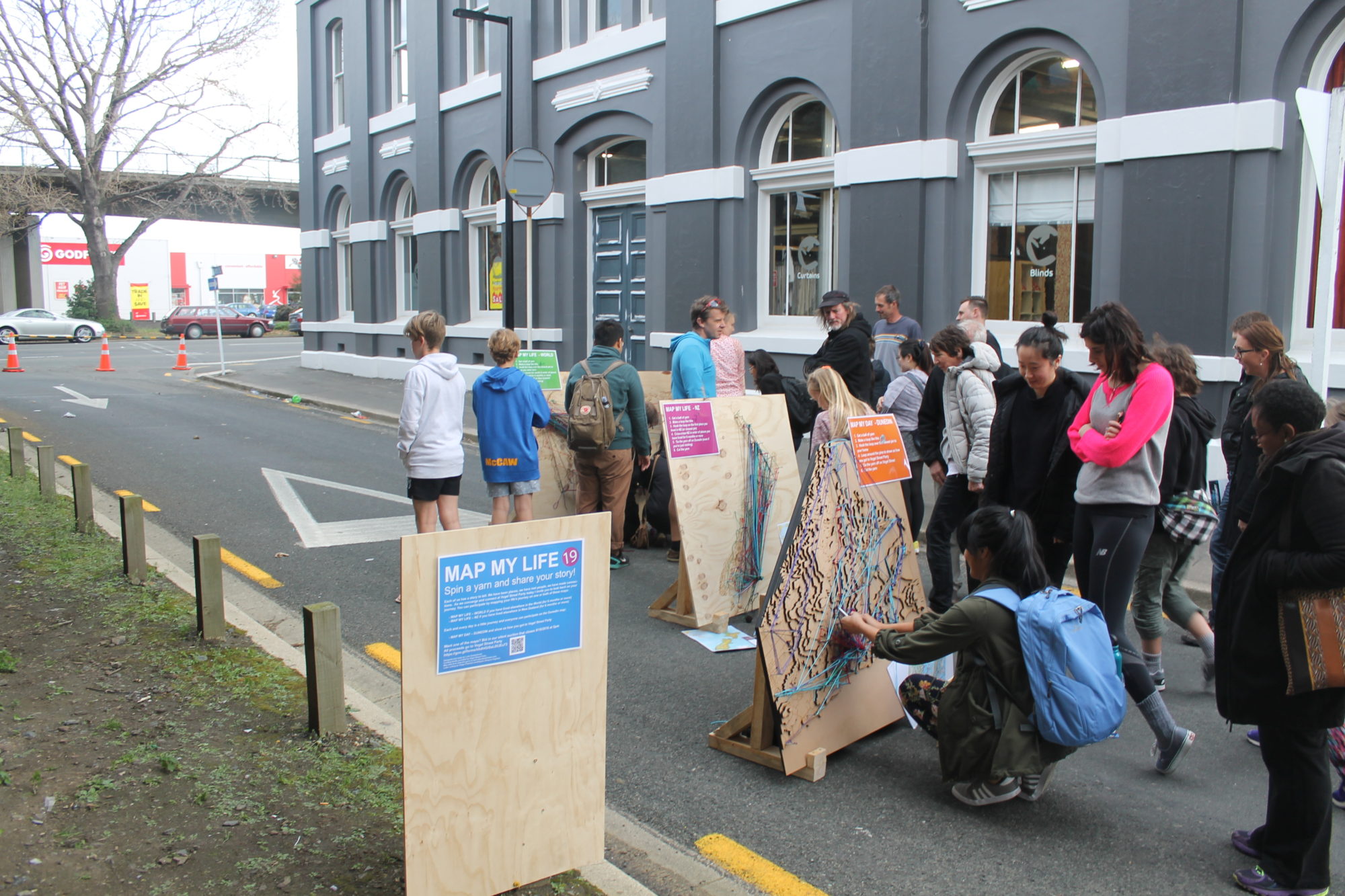
I created an interactive installation called "Map my life" for Vogel Street Party 2016 which was held on October the 8th 2016. The installation was set up near the corner of Vogel and Jetty street closer to the one-way south.
The concept - Map my life
The concept for this work is best explained using the same signage I used on the day.
MAP MY LIFE Spin a yarn and share your story! Each of us has a story to tell. We have been places, we have met people, we have made connections. As we converge and connect at Vogel Street Party today I invite you to look back on your journey. You can participate by mapping your life's journey on one or both of these maps:
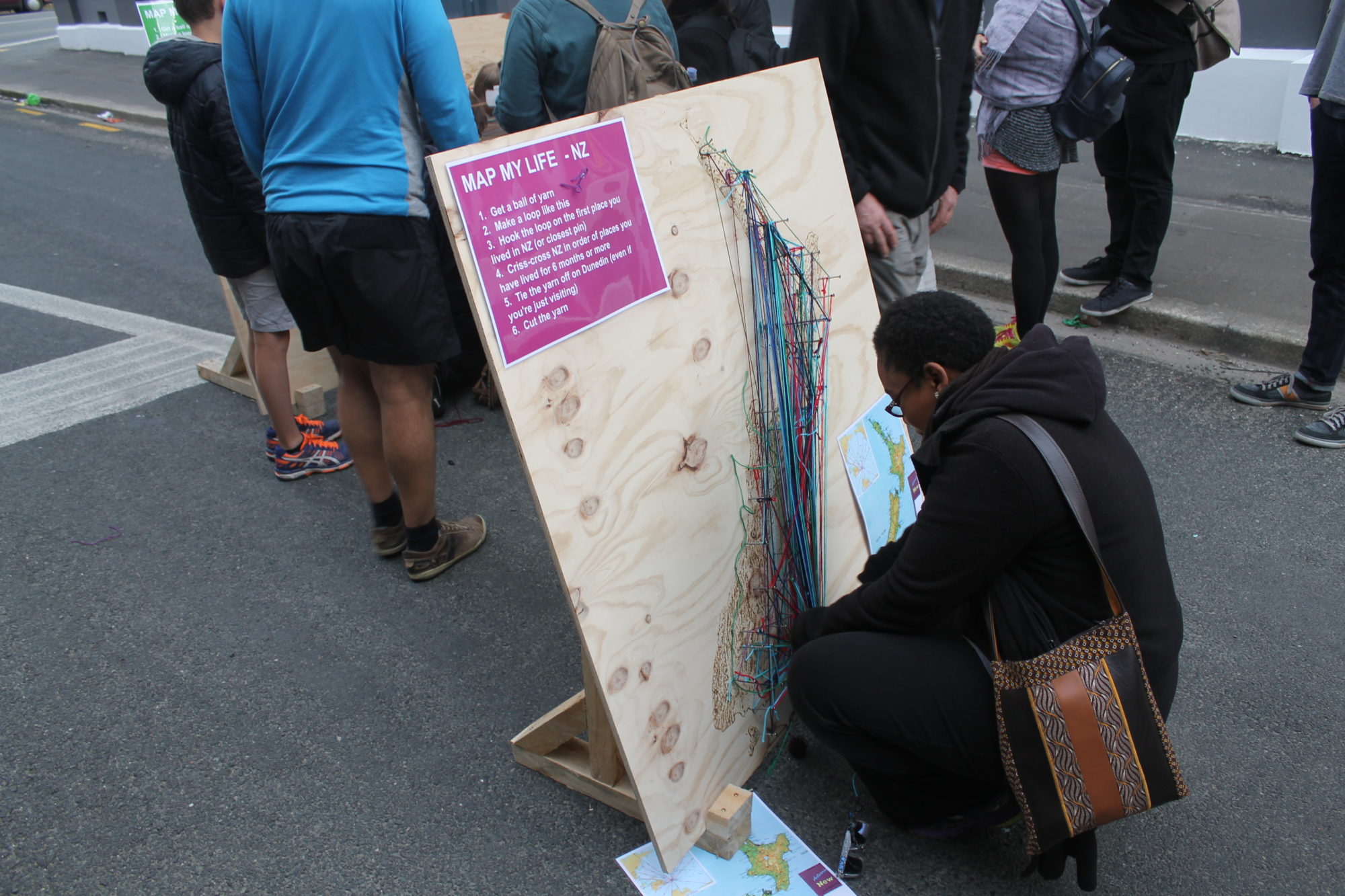
Map my life signage
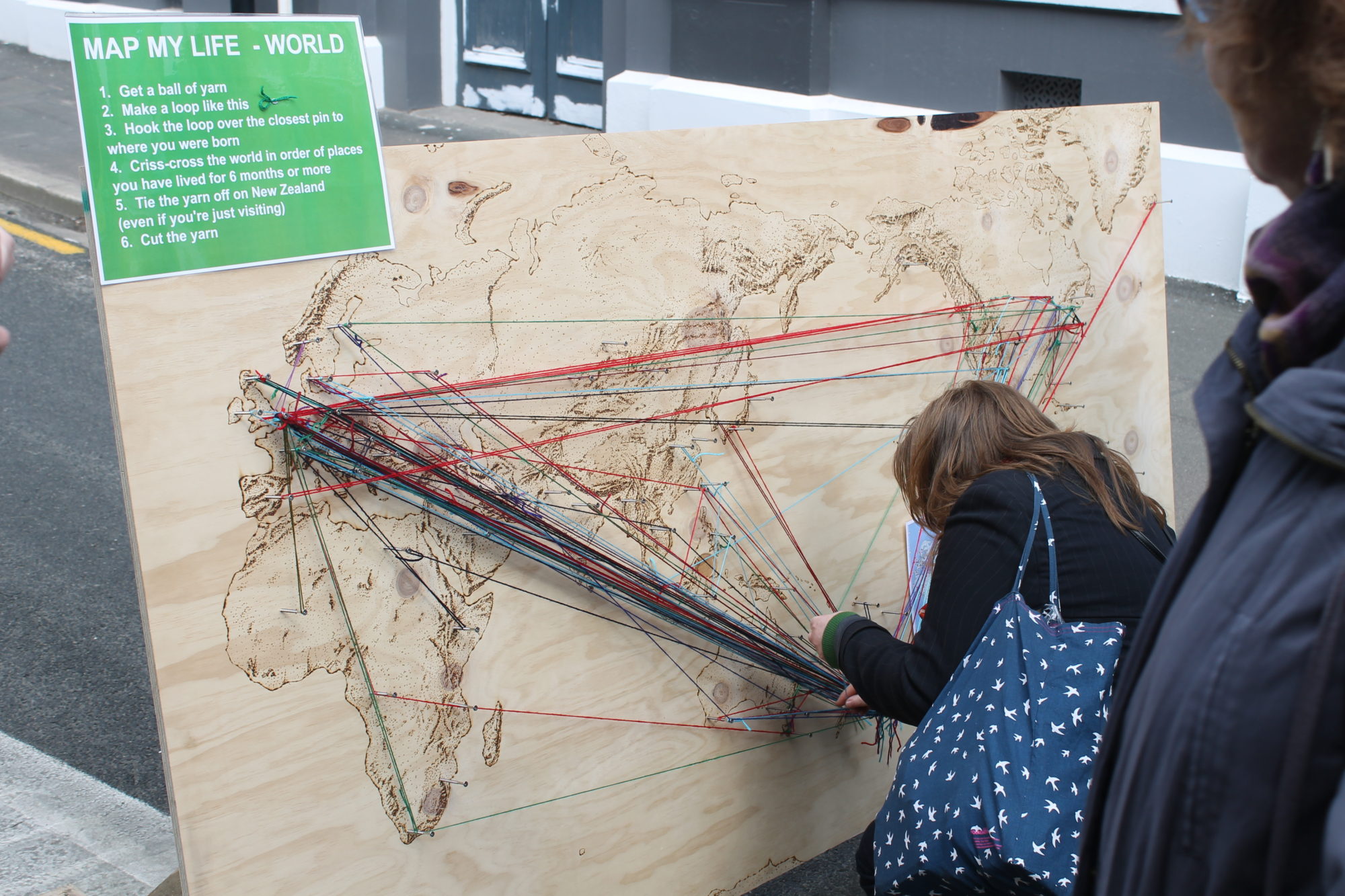
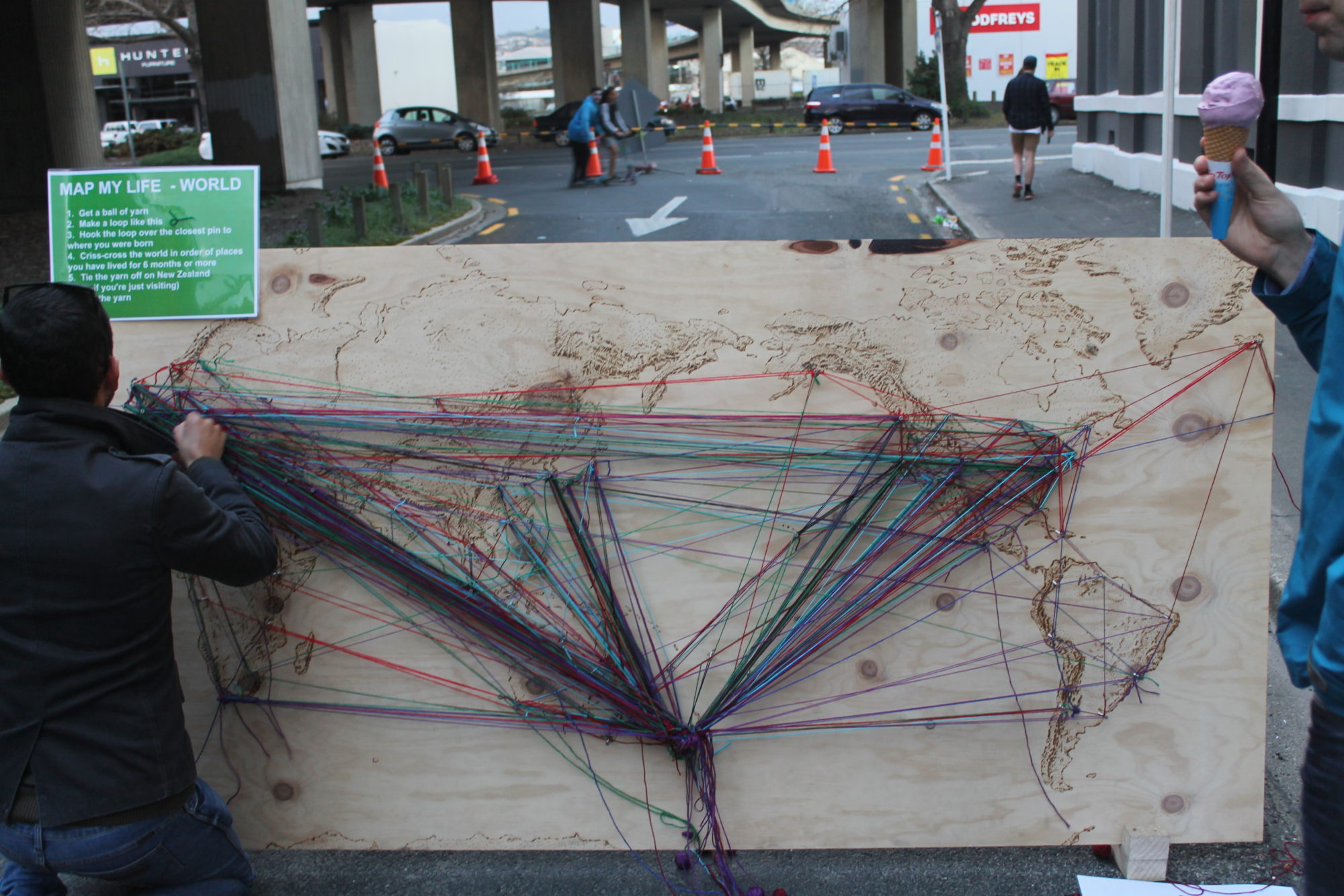
MAP MY LIFE – WORLD if you have lived elsewhere in the World (for 6 months or more)
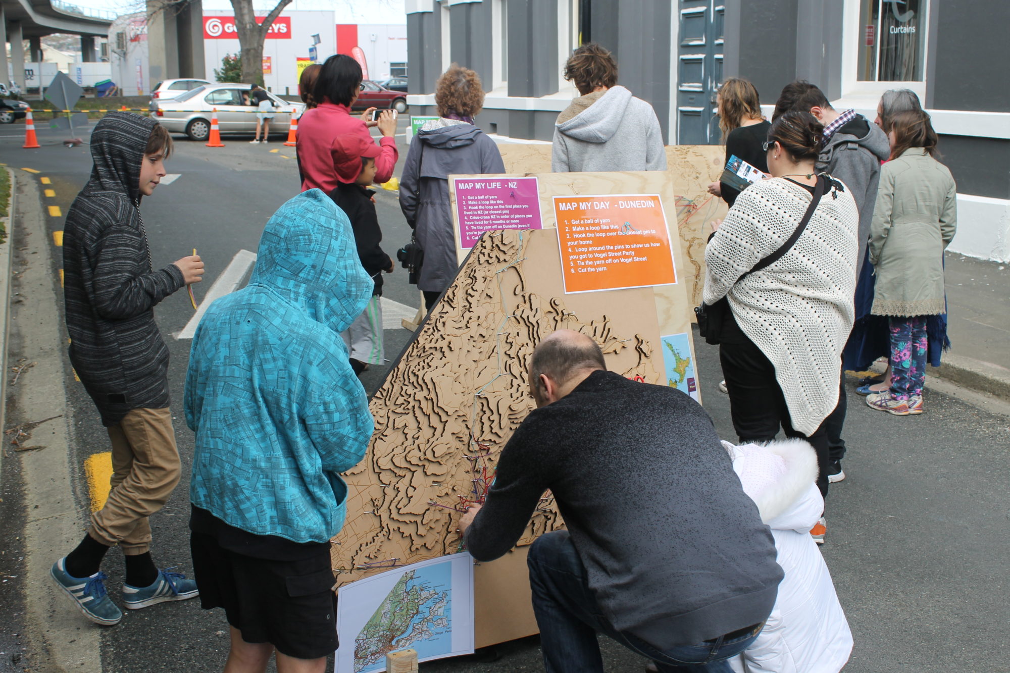
MAP MY LIFE – NZ if you have lived elsewhere in New Zealand (for 6 months or more)
Each and every day is a little journey and everyone can participate on the Dunedin map:
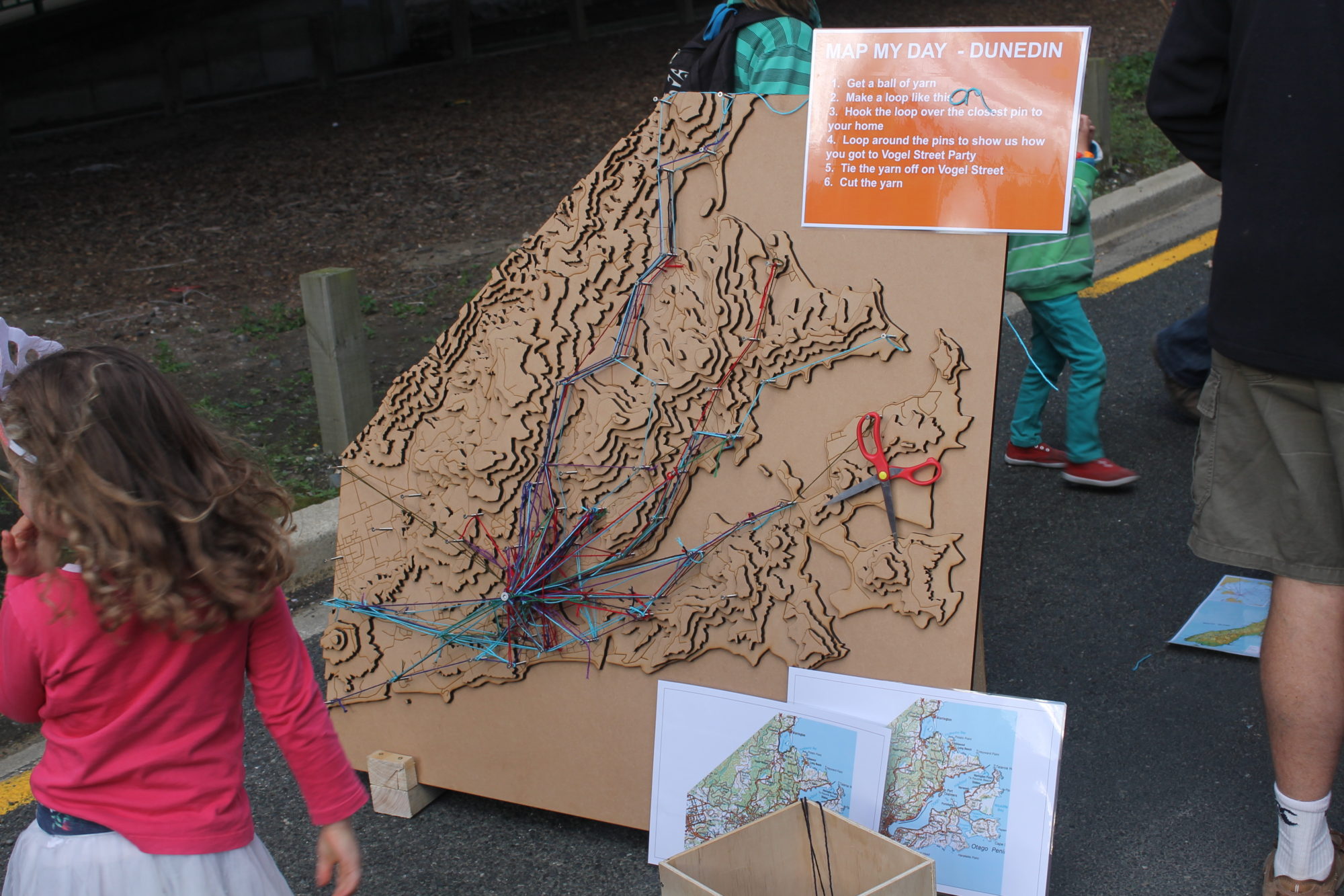
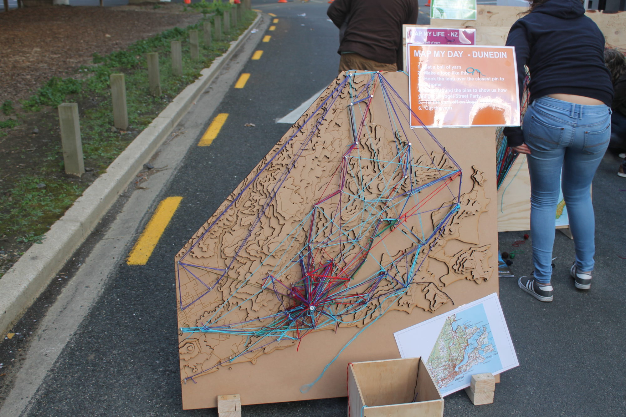
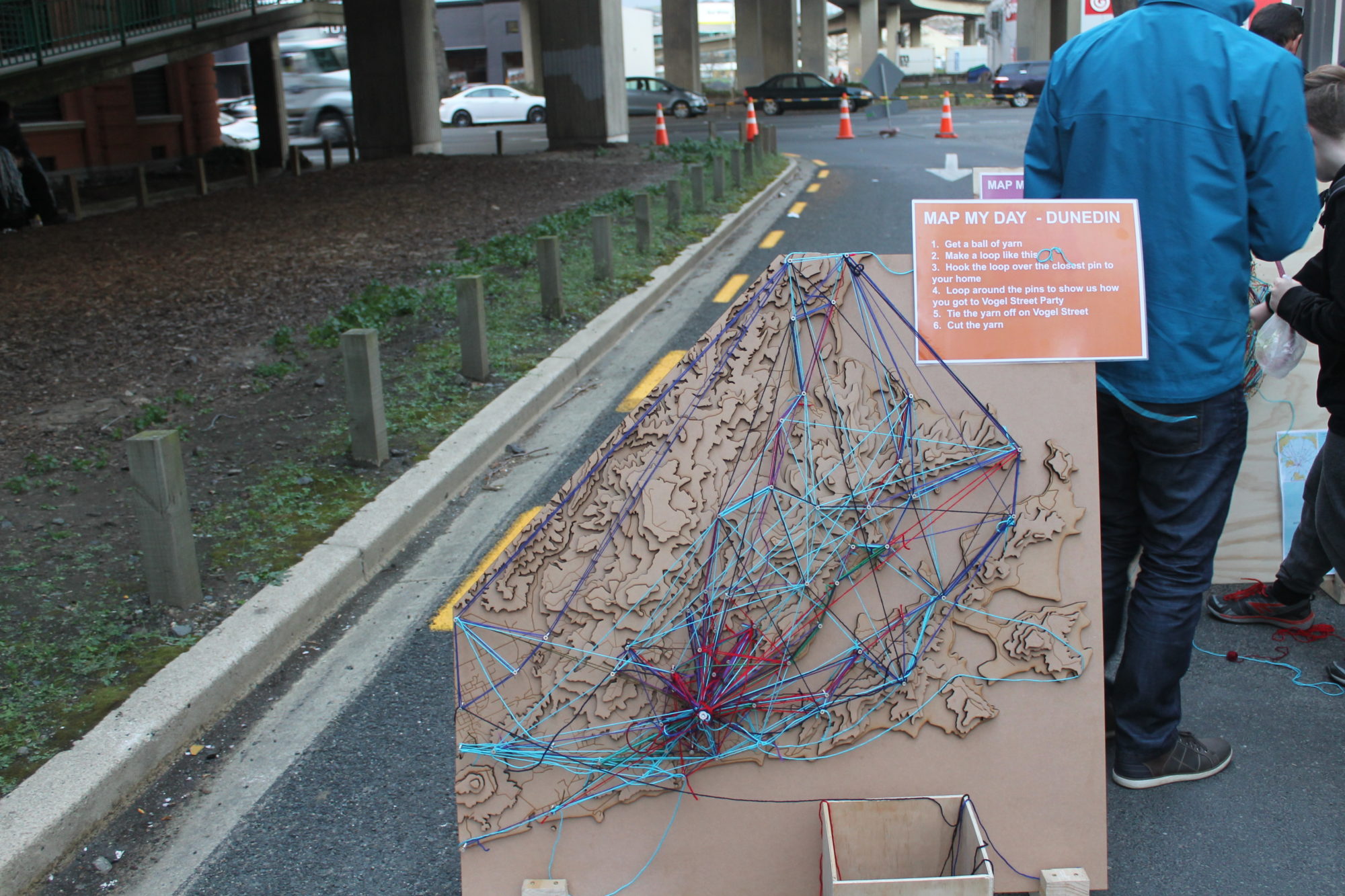
MAP MY DAY – DUNEDIN and show us how you got to Vogel Street Party
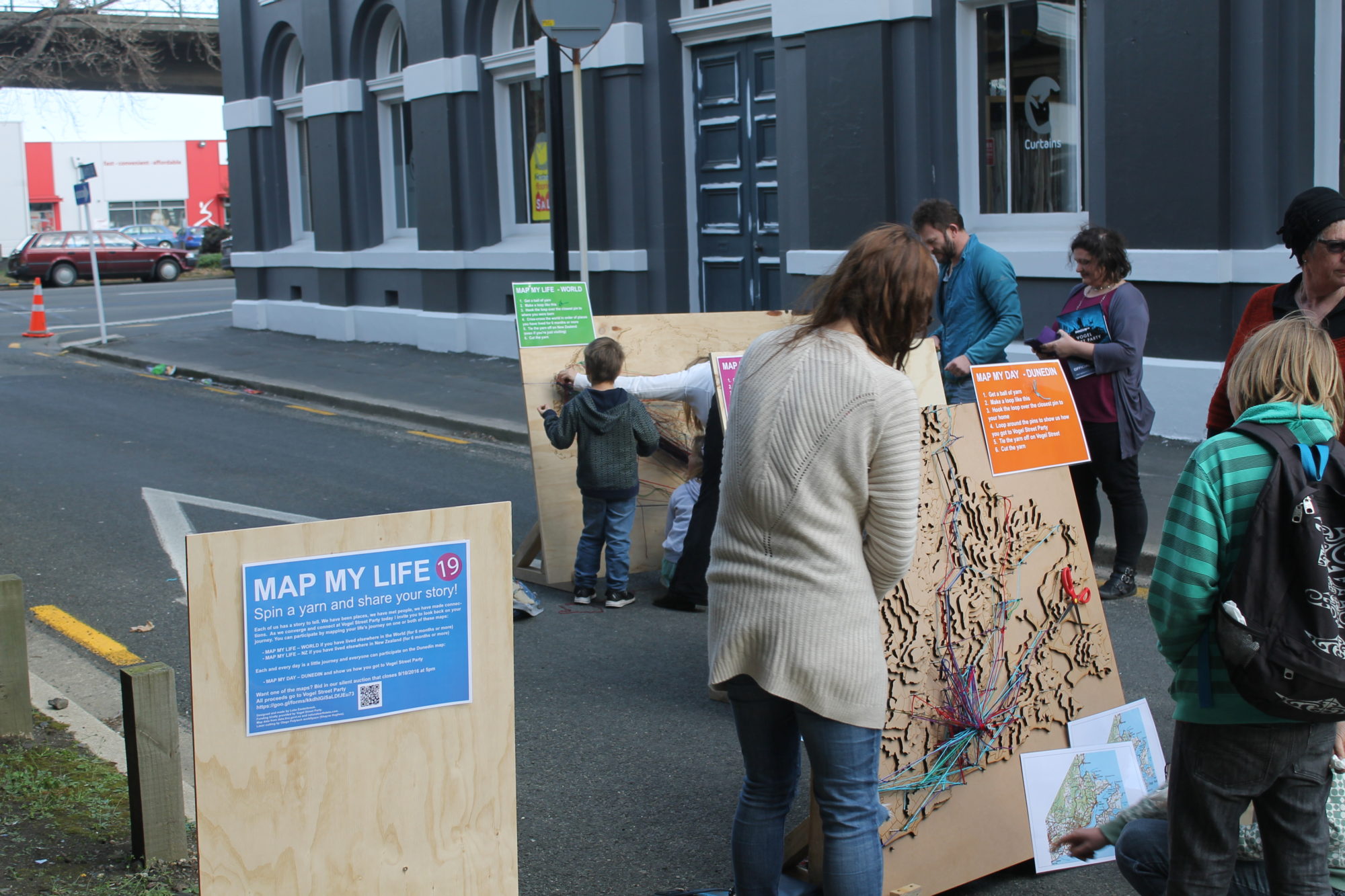
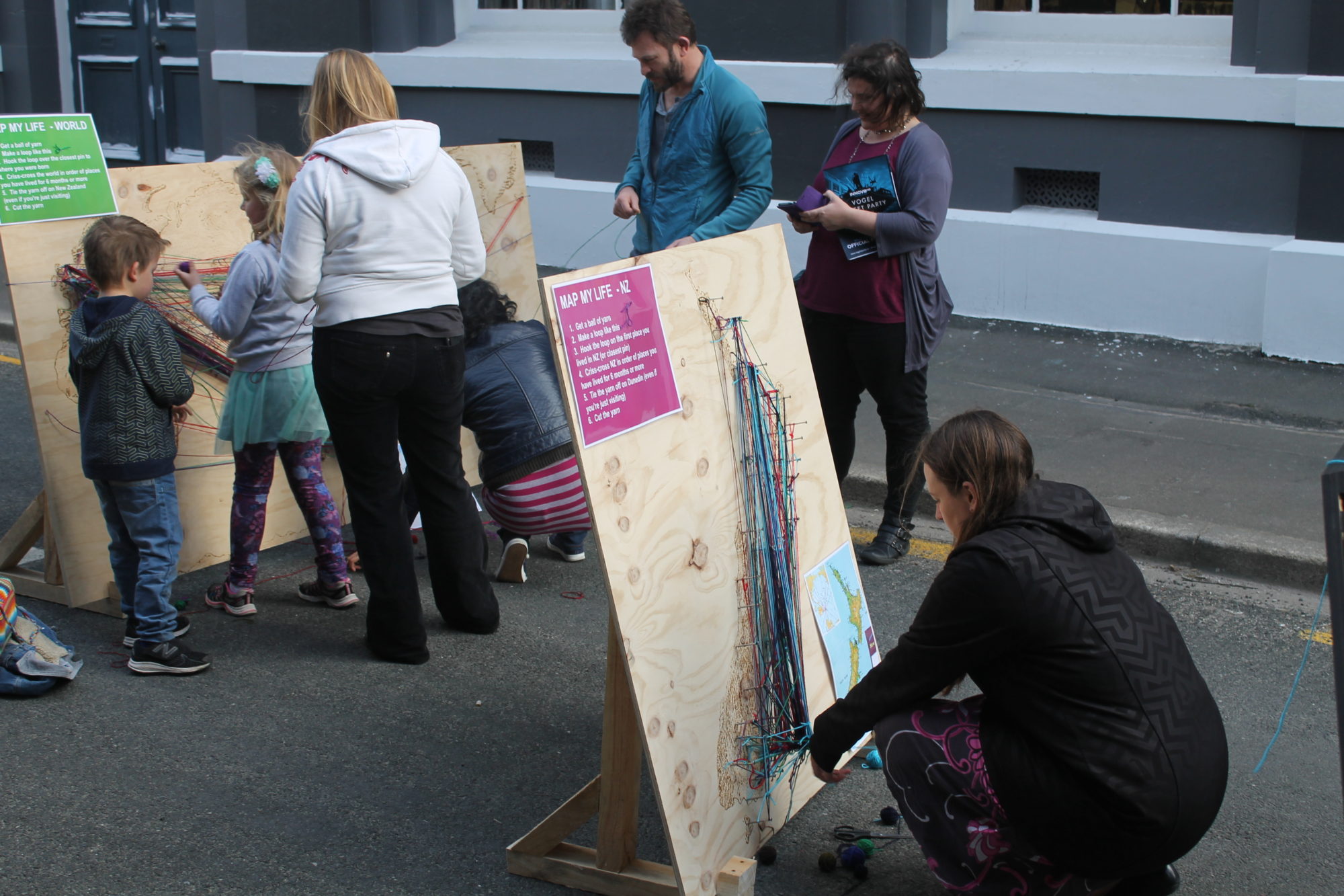
People were instructed to map their life using yarn by starting where they were born and connecting locations they have lived for 6 months or more before ending up in NZ or Dunedin. For map my day they were instructed to start from where they live and connect along the road network to Vogel St Party using Yarn.
The works
I created three works for this interactive installation.
World map
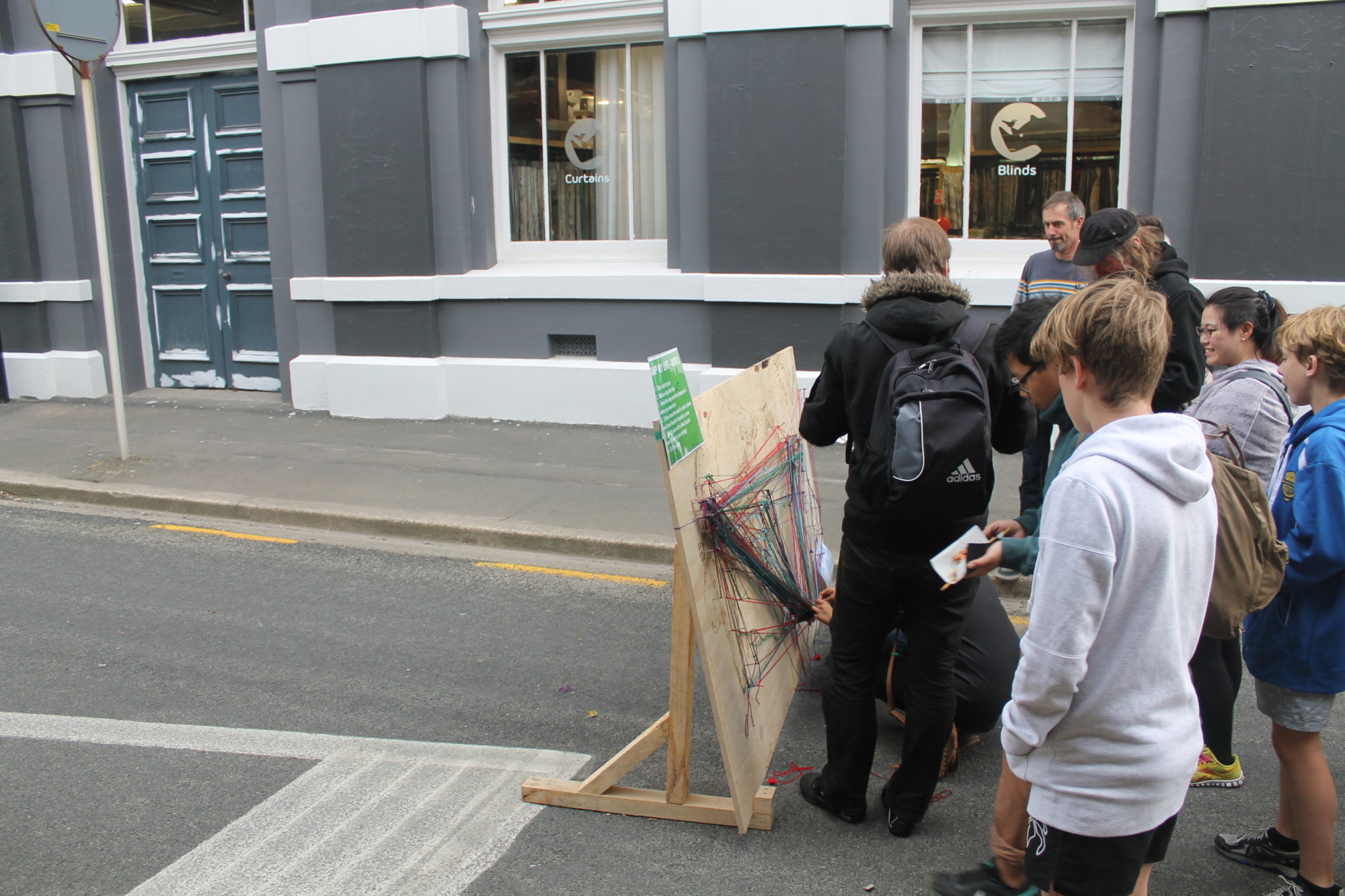
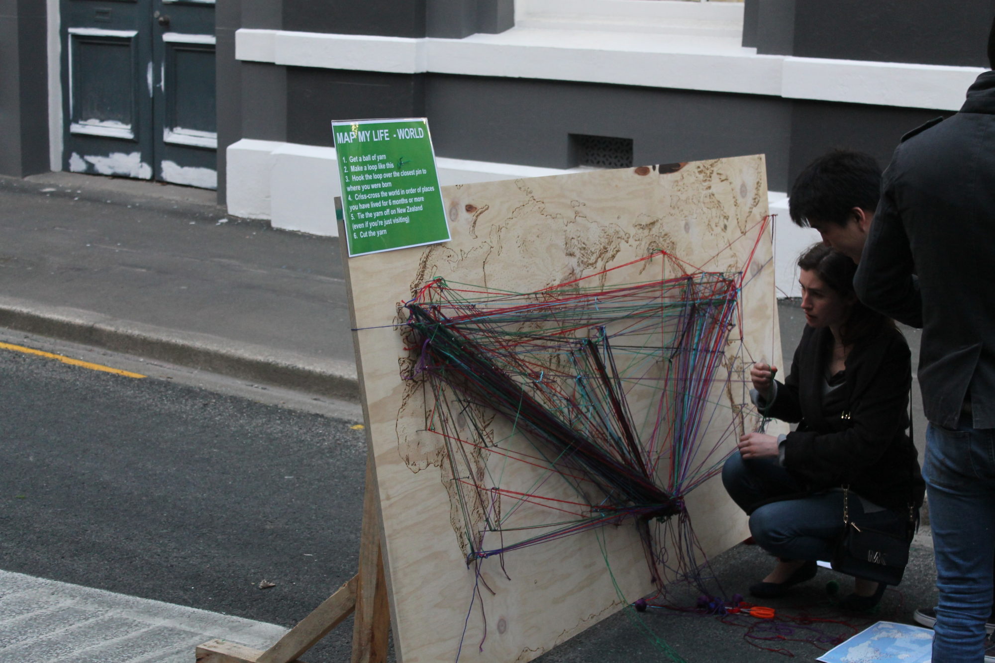
MAP MY LIFE – WORLD
A 2.4m by 1.2m plywood sheet with a world map burnt onto it by hand including a stipple pattern for the hillshade (terrain). Approximately 80 screws were located at major population centres around the world. A large screw was placed in the middle of NZ.
NZ map
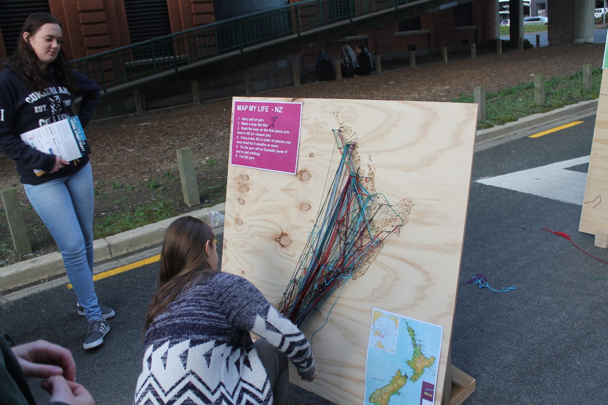
MAP MY LIFE – NZ
A 1.2m by 1.2m plywood sheet with a New Zealand map burnt onto it by hand including a stipple pattern for the hillshade (terrain). Approximately 45 screws were located at major population centres around NZ. A large screw was placed in Dunedin.
Dunedin map
MAP MY DAY – DUNEDIN
1.2m by 1.2m by ~7cm deep laser cut model of Dunedin. Each level represents 100m contour with roads laser engraved (both from LINZ topo250 dataset). Approximately 45 screws located at major population areas and along major road networks. A large screw was positioned at Vogel street.
Other bits and pieces
Other bits and pieces included:
A box of small balls of yarn
Reference maps to help people find places
Instructions
Stands for the maps
The interaction
It's always a nervous thing to setup any interactive artwork. But things were looking good when we had some people starting to map their lives before we had even finished setting up.
There were a steady stream of people throughout the day. I estimate 1000 + people mapped their life and/or day by laying down ~1km of yarn!
Look at the images below to see how the work progressed through the day.

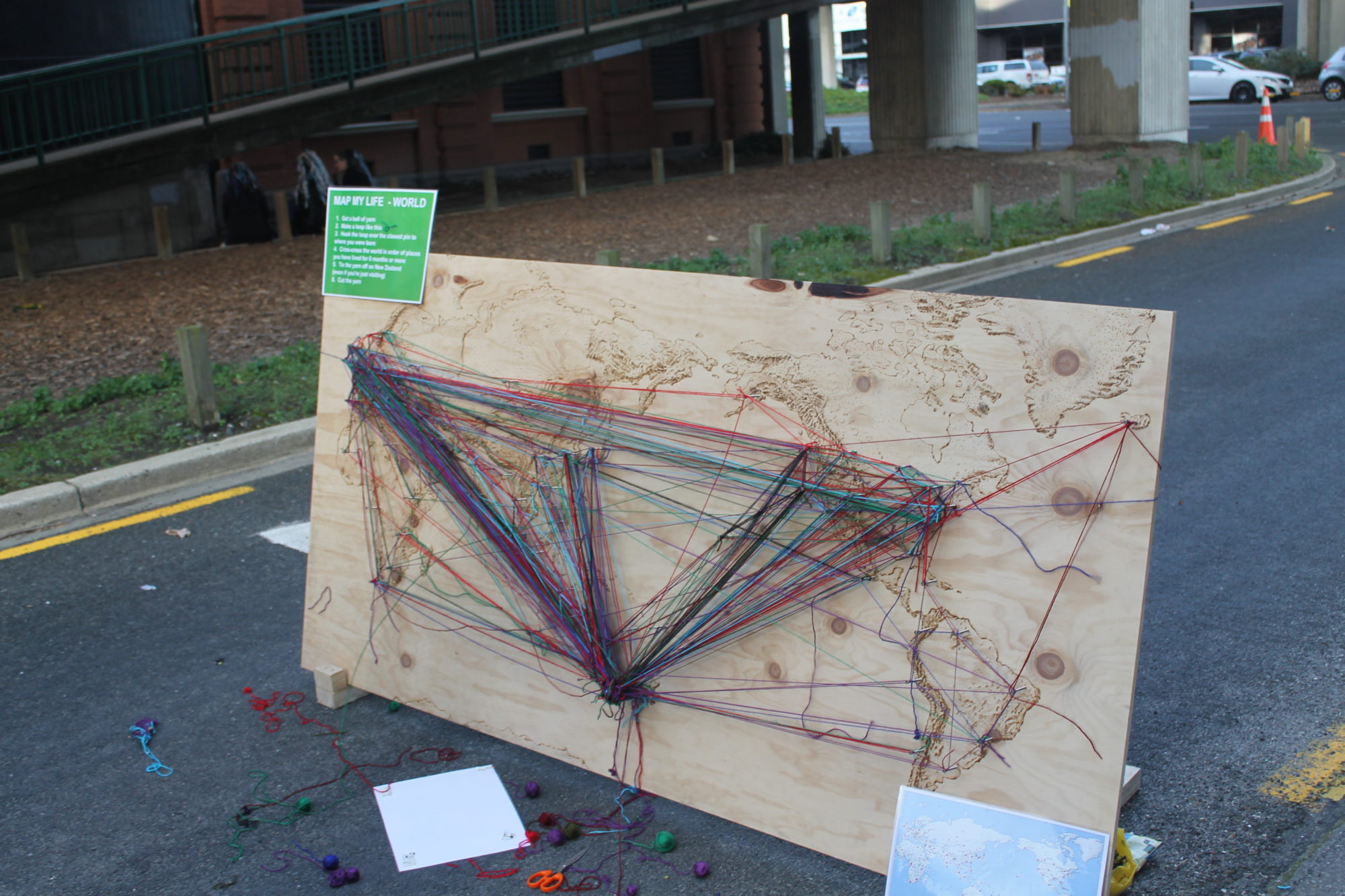
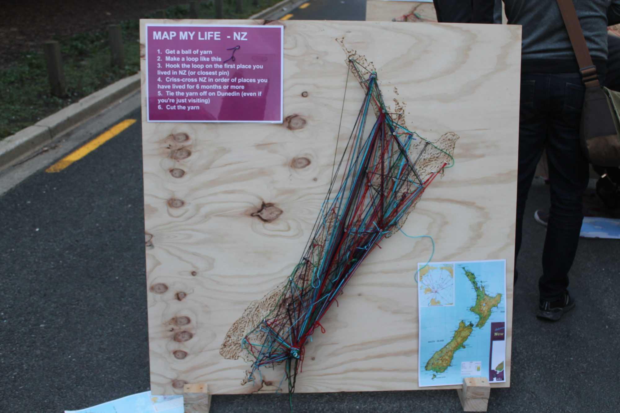
The finished work


Acknowledgements
Thanks so much to Vogel Street party for funding this project. Thanks also to all the people that helped before and on the day.
Licence for reuse

'Map My Life' by Luke Easterbrook is licensed under a Creative Commons Attribution-ShareAlike 4.0 International License.
Based on a work at https://lukeeasterbrook.org/